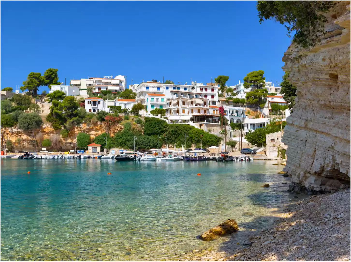
 Small boats in the cove and houses on the slope, across from the pebble shore of Alonissos.
On the eastern side of the Northern Sporades, Alonissos spreads its wooded slopes above small coves, often leaving little room between the pines and the sea. Present-day life on the island gathers around Patitiri. Higher up, in Old Alonissos, the houses draw close to one another and the lanes open unexpectedly towards the sea, which from certain points can be seen beyond the tiled roofs.
Such contrasts turn up even on short walks. A wooded slope gives way to bare rock; a little lower down a cove with houses comes into view, while towards the more remote shores the vegetation thins and the ground grows rougher.
The green of Alonissos and the shape of its coast
In the south and centre of the island, where the Aleppo pine is a defining element of the vegetation, the woods are broken by olive groves and by clearings through which the sea can be glimpsed. Further north the picture changes: strawberry trees form dense thickets in places, and there are stretches of low, phrygana-type scrub. This variation is recorded in the botanical survey by Cristina Cattaneo and Mauro Grano, available on ResearchGate.
Between the hills run deeper folds and ravines. Where the trees grow sparse the stone shows through more plainly, pale at times under the sun, at others dark in the shadow of a slope that may run right down to the water. The coastline varies accordingly — gentle approaches in some bays and, a little further on, sheer rock faces.
Close to the shoreline it is the shifts of colour that stand out. Over the pale pebbles the water lets the seabed show; towards deeper water it takes on stronger turquoise tones, until blue prevails beyond the mouth of the cove.
Patitiri, the present-day capital
Patitiri is the main port and the present-day capital of Alonissos, home to the administrative services and to much of the island’s commercial activity. Its buildings climb the slopes around the harbour, following the lie of the land, and the waterfront ties the arrival of the boats to the everyday comings and goings of the town. Its role as the modern centre is described by the Natural Environment and Climate Change Agency (NECCA).
From the sea the successive tiers of houses read more clearly, balconies jutting out above the lower roofs and trees filling some of the gaps between buildings. Walking along the quay, attention shifts to the moored boats and the shopfronts, where the place takes on the scale of an ordinary daily route.
The name points to the patitiria, the treading floors where grapes were pressed. The island’s older association with wine production gives it a specific local meaning, one illuminated by the historical overview on ToposText, which also mentions the wine trade of ancient Ikos.
Old Alonissos on its hill
In Chora, as Old Alonissos is known, the sea is seen from above, beyond the roofs and the hillsides. This was the island’s old centre until the earthquake of 1965, which caused serious destruction and led residents to move down to Patitiri, a development recorded by ToposText.
Chora today keeps its tightly packed houses and narrow passages. You sense this on foot, as façades close in on each other and the streets change direction around the buildings; a small opening is then enough for the sea, lost a moment earlier behind a wall, to reappear. In the oldest part, around the Kastro, the settlement grows denser still.
From a distance the clustered mass of houses on the hilltop dominates. Inside the lanes, however, the eye lingers on low thresholds and small courtyards, and the tiled roofs are often seen from a lower level, between walls that narrow the sky.
Afternoon light falls obliquely on some façades and leaves others in shadow, depending on the turn of the street.
From Votsi to Steni Vala and Kalamakia
The smaller coastal settlements lie mainly on the south-eastern side of Alonissos, where the shores are generally gentler than those to the north-west. At Votsi, Steni Vala and Kalamakia the little harbours bind habitation to fishing and to movement by sea, a relationship also discussed in Konaxis’s study, posted on ResearchGate.
In these coves the distance between house and water shrinks. The quay follows the contours of the shore, boats are moored close together, and the slope rises straight behind the buildings, with trees that often reach into the yards. At Votsi, the steep rocky sides of the inlet give that closeness a particular intensity.
Long and narrow, the inlet of Steni Vala lets the sea reach into the land between the hillsides. At Kalamakia the settlement gathers around its small harbour, where fishing boats remain part of the scene in front of the seafront shops.
Beaches of differing character
At Kokkinokastro the first thing one notices is the colour of the land. The reddish headland juts out over the sea and turns a deeper orange in low light, as ToposText notes. Beneath this rocky mass the shore looks more exposed, and the blue of the water heightens the warm hue of the earth all the more.
Among the island’s better-known beaches are also Agios Dimitrios and Leftos Gialos, together with Chrysi Milia, as listed by NECCA. From one beach to the next the opening of the bay changes, and so does the distance between the vegetation and the water; in some places the eye passes almost unhindered to the open sea, in others it is held between nearby headlands.
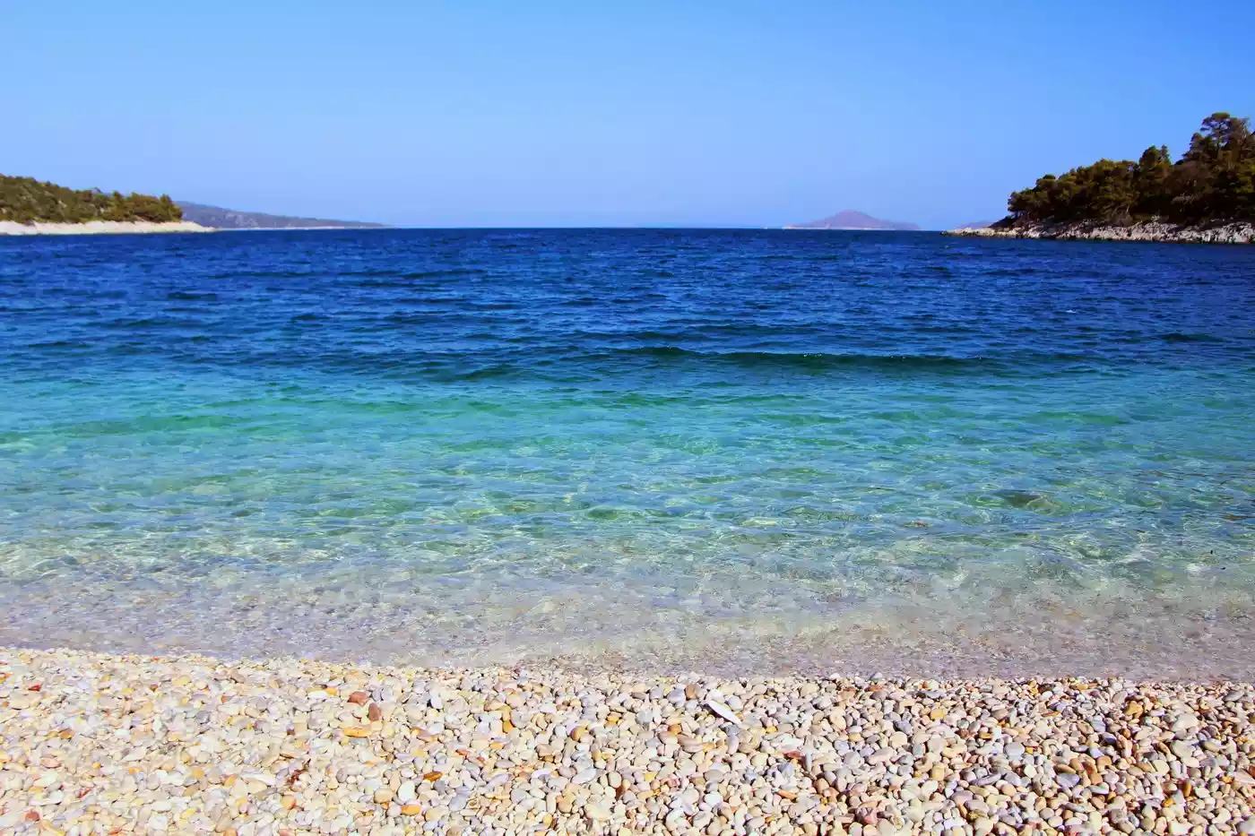 Pebble shore on Alonissos. Photograph: Eleni Afiontzi / Unsplash. Published 15 September 2021.
On the pebble beaches, what happens in the first few metres of water deserves attention too. The small stones can be seen beneath the ripples; they darken as soon as they are wet and seem to warp with every movement of the surface. Further out, as the seabed fades from view, the sea deepens in colour, while the wooded ends of the bay stay off to the side.
The seascape beyond the shore
Alonissos lies within the National Marine Park of Alonissos and the Northern Sporades, established in 1992 and extending over neighbouring islands and islets together with their surrounding waters. Of particular importance is the protection of the Mediterranean monk seal, for which Piperi is a critical breeding area and the core of the Park, according to NECCA.
Seen from the shores of Alonissos, the neighbouring islands appear sometimes in sharp outline and sometimes fainter, veiled in haze. In a sheltered cove the water may stay almost motionless near the land, while a little further out small ripples can be made out, where the headland’s shelter comes to an end.
Sources and Bibliography
- Cattaneo, C. and Grano, M. (2011). Indagine preliminare sulla flora dell’isola egea di Alonissos (Sporadi settentrionali, Grecia). Bollettino della Società Naturalisti “Silvia Zenari”, 35, pp. 81–100.
- Konaxis, I. (2020). Alonissos Island and the Northern Sporades Marine National Park as a Strategic Socio-Economic Node for the Culture of the Aegean Sea. American Research Journal of Humanities & Social Science, 3(10), pp. 49–53.
- ToposText. (n.d.). Ikos (Alonnisos). Geographical and historical entry.
- Natural Environment and Climate Change Agency (NECCA). (n.d.). Εθνικό Θαλάσσιο Πάρκο Αλοννήσου – Βορείων Σποράδων, Ανατολική Σκόπελος [National Marine Park of Alonissos – Northern Sporades, Eastern Skopelos].
- Natural Environment and Climate Change Agency (NECCA). (n.d.). Μονάδα Διαχείρισης Σποράδων [Sporades Management Unit]. Sections on the natural and built environment.


